Deep Depression Nears Odisha-Andhra Coast: IMD Warns of Extremely Heavy Rain in Telangana, Odisha and Coastal Andhra
A deep depression over the Bay of Bengal is nearing the north Andhra Pradesh–south Odisha coast as IMD warns of extremely heavy rain in parts of Telangana, Odisha and coastal Andhra Pradesh.
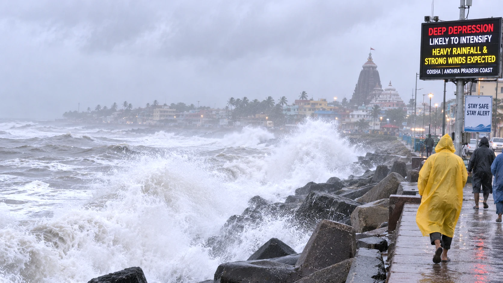
Heavy rain and rough weather along the Odisha-Andhra Pradesh coast as a deep depression approaches on September 23, 2026
Table of Contents (27 sections)
A deep depression over the west-central and adjoining northwest Bay of Bengal was moving towards the north Andhra Pradesh–south Odisha coast on Wednesday, September 23, with the India Meteorological Department warning of very heavy to extremely heavy rainfall across parts of Odisha, Andhra Pradesh and Telangana.
As of the latest official coastal bulletins available during the afternoon, the system had not yet crossed the coast.
IMD said it was likely to move west-northwestwards and cross between Visakhapatnam and Gopalpur, close to Kalingapatnam, as a deep depression by the night of September 23.
Recommended Reading
Related Stories & In-Depth Guides
Curated editorial perspectives matching this topic.
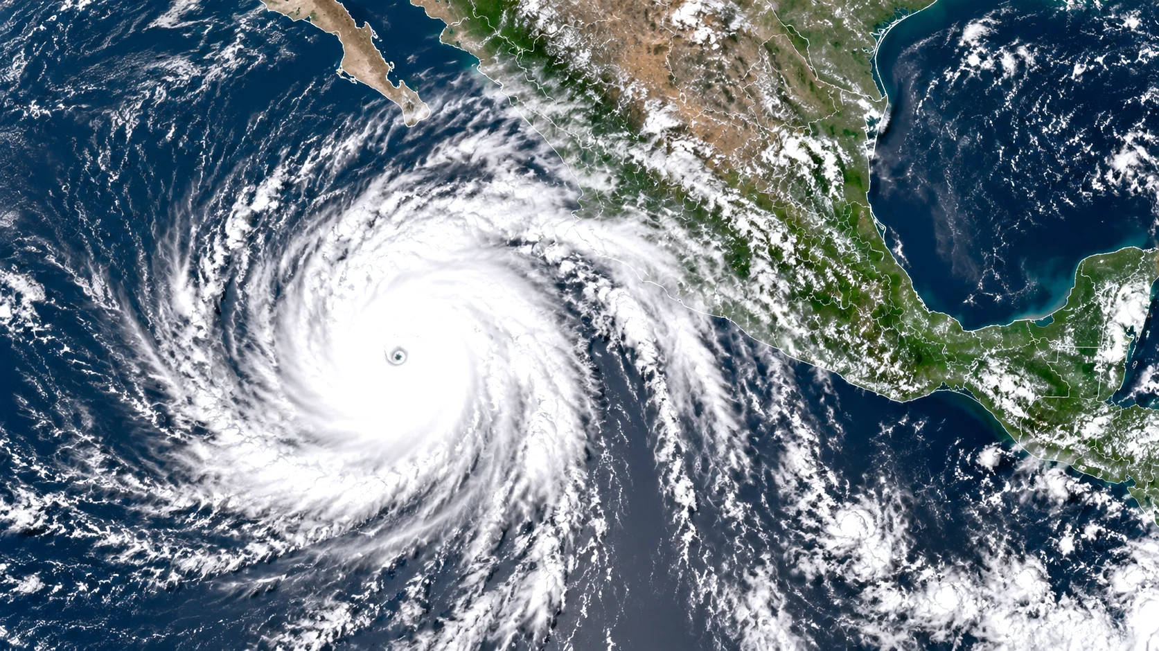
Hurricane Polo has weakened slightly from Category 5 to a powerful Category 4 storm off southwest Mexico, while outer rainbands reach the coast and raise flooding, mudslide and dangerous-surf risks.
The Home Ministry has formally added the Shahzad Bhatti Network to the First Schedule of the UAPA, citing alleged cross-border arms, explosives and narcotics smuggling, recruitment of local criminals and the use of digital platforms for terror-related activity. The designation follows a multi-state
The system is already influencing weather across eastern and southern India, with rainfall warnings extending beyond the immediate landfall zone into Telangana and Chhattisgarh.
IMD's September 23 warning places Telangana under an extremely heavy rainfall warning for September 23 and 24, followed by very heavy rainfall warnings for September 25 and 26.
Odisha and coastal Andhra Pradesh are also facing significant rainfall warnings as the system approaches the coast.
Key Takeaways
Deep depression approaching north Andhra–south Odisha coast.
Expected to cross near Kalingapatnam by night of September 23.
Telangana under extremely heavy rain warning on September 23–24.
Odisha and coastal Andhra also face extremely heavy rain alerts.
System remains a deep depression, not a named cyclone.
Rough seas and squally winds along the coast.
Deep Depression Latest Status: What IMD Says
The deep depression developed over the west-central and adjoining northwest Bay of Bengal after strengthening from a depression on September 22.
An IMD sea-area bulletin placed the system at 11:30 p.m. on September 22 about:
100 km east-southeast of Kalingapatnam in Andhra Pradesh;
150 km south of Gopalpur in Odisha;
220 km south-southwest of Puri; and
180 km east-northeast of Visakhapatnam.
It was moving westwards at around 7 kmph at that stage.
Because the system has continued moving towards the coast, those distances should not be treated as its position later on September 23.
The important current forecast is the expected crossing zone: north Andhra Pradesh–south Odisha, between Visakhapatnam and Gopalpur, close to Kalingapatnam.
Has the Deep Depression Crossed the Coast?
Not yet, according to the latest IMD information available at the time of verification.
Reports published during Wednesday morning and early afternoon continued to describe the system as approaching the coast, with landfall expected by Wednesday night.
For that reason, descriptions saying the system has already “crossed the Odisha-Andhra coast” would be premature unless IMD issues a later landfall confirmation.
Weather systems can change speed and track over short periods, so the exact crossing time should continue to be treated as an evolving forecast until IMD confirms it.
Is This Cyclone Arnab?
The system is officially classified as a deep depression, not a named cyclonic storm.
Earlier speculation focused on whether it could strengthen into the next named cyclone, which would be called Arnab under the regional naming list.
However, IMD forecasts cited by officials expected the system to cross the coast as a deep depression rather than a cyclonic storm.
That distinction matters.
A deep depression can still bring:
very heavy or extremely heavy rainfall;
strong winds;
rough seas;
local flooding;
waterlogging;
tree damage;
and transport disruption.
A system does not need to become a named cyclone to create significant weather impacts.
Telangana Rain Alert: Which Districts Face the Highest Risk?
Telangana is expected to receive some of the system's heaviest inland rainfall as the circulation moves westwards after approaching the coast.
For September 23, IMD-based warnings indicate very heavy to extremely heavy rainfall may occur at isolated places in:
Peddapalli;
Jayashankar Bhupalapally;
Mulugu;
Bhadradri Kothagudem;
Khammam;
Mahabubabad;
Warangal; and
Hanamkonda.
These are predominantly eastern and northeastern districts, placing areas closer to the Andhra Pradesh and Chhattisgarh sides of Telangana under the strongest rainfall risk.
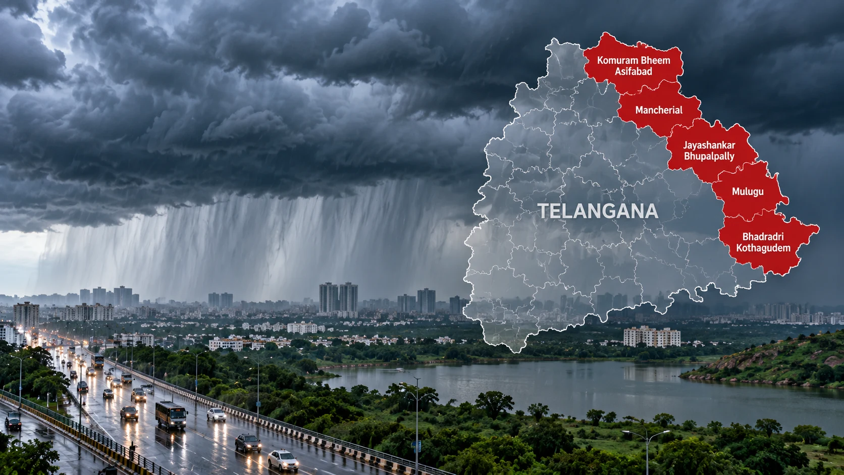
For September 24, the highest warning shifts partly northwards, with very heavy to extremely heavy rainfall forecast at isolated locations in:
Komaram Bheem Asifabad;
Mancherial;
Karimnagar;
Peddapalli;
Jayashankar Bhupalapally;
Mahabubabad;
Warangal; and
Hanamkonda.
The broader IMD state warning remains at the extremely heavy rainfall category on both September 23 and September 24.
What Does “Extremely Heavy Rain” Mean?
IMD uses defined rainfall categories.
In general, extremely heavy rainfall refers to rainfall of about 204.5 mm or more within 24 hours at a location.
That does not mean every district under a warning will receive that amount.
Warnings for “isolated” extremely heavy rain mean one or a small number of locations within the warned region could experience such intense rainfall, while nearby areas may receive considerably less.
That distinction is important when reading a state-wide red alert.
A red warning does not mean the entire state will receive identical rainfall.
Hyderabad Rain Forecast: Is the City Under the Red Alert?
Hyderabad is not among the eastern Telangana districts specifically listed in the September 23 red-alert group cited above.
However, Hyderabad and surrounding districts remain exposed to thunderstorms, locally heavy rain, lightning and gusty winds.
Current local weather guidance for Hyderabad includes a yellow lightning watch, with thunderstorms and gusty winds possible at isolated places in Hyderabad and several surrounding districts.
Earlier IMD-based forecasts also placed Hyderabad, Medchal-Malkajgiri, Rangareddy, Vikarabad, Sangareddy, Medak, Kamareddy and Yadadri Bhuvanagiri under rainfall warnings through this spell.
The heaviest rainfall risk, however, is currently focused farther east and northeast in Telangana.
Why Telangana Is Being Affected by a Coastal System
Although the deep depression is expected to cross the coast hundreds of kilometres east of Hyderabad, its circulation is expected to continue moving inland.
Such systems can carry large quantities of moisture westwards after landfall.
As the circulation passes across or near Telangana, it may produce:
widespread rain;
intense local downpours;
thunderstorms;
lightning;
and gusty surface winds.
The New Indian Express reported that IMD expected rainfall to intensify across Telangana, particularly in eastern and northeastern districts, as the system moved inland.
Telangana Warning Timeline
Date
IMD Telangana warning
September 23
Extremely heavy rain; thunderstorms/lightning; strong surface winds
September 24
Extremely heavy rain; thunderstorms/lightning; strong surface winds
September 25
Very heavy rain; thunderstorms/lightning
September 26
Very heavy rain; thunderstorms/lightning
September 27
No subdivision-level warning currently shown
These warnings can be revised as the deep depression changes position and intensity.
Residents should therefore check the latest district-level IMD bulletin rather than relying solely on an earlier forecast.
Odisha Rain Alert: Southern Districts at Higher Risk
Odisha faces both the approaching circulation and the immediate coastal rainfall associated with the deep depression.
IMD's subdivision warning places Odisha under an extremely heavy rainfall warning on September 23 and September 24, followed by a very heavy rainfall warning on September 25.
Current reports based on IMD warnings identify southern Odisha as the most vulnerable region.
For September 23, red-alert conditions have been reported for districts including:
Gajapati;
Ganjam;
Rayagada; and
Koraput.
Other IMD-based alerts over the September 23–25 period have included Kalahandi, Nabarangpur and Malkangiri as the system progresses inland.
The exact district warning varies by date, which means readers should not interpret one day's red-alert list as applying unchanged throughout the whole event.
Schools and Preparedness Measures in Odisha
Authorities in several vulnerable Odisha districts have closed schools and Anganwadi centres as a precaution.
Disaster-response teams have also been deployed in southern districts, while additional teams have been kept in reserve.
Officials have identified cyclone and multipurpose shelters in case local evacuation becomes necessary.
These actions are precautionary measures and do not mean every warned district will experience severe damage.
Authorities are responding to the possibility of intense rainfall, flooding, strong winds and local infrastructure disruption.
Andhra Pradesh Rain Alert
Coastal Andhra Pradesh is directly in the expected crossing zone.
IMD's subdivision forecast issued for coastal Andhra Pradesh placed the region under an extremely heavy rainfall warning for September 23, followed by a very heavy rainfall warning for September 24.
Andhra Pradesh disaster-management officials have also warned of significant rainfall in districts including:
Visakhapatnam;
Anakapalli;
Kakinada;
Konaseema;
East Godavari;
West Godavari; and
Eluru.
A September 23 afternoon nowcast also covered districts including Srikakulam, Vizianagaram, Visakhapatnam, Anakapalli, Kakinada, Konaseema, Eluru, West Godavari, East Godavari and Alluri Sitharama Raju for thunderstorms and rain.
Kalingapatnam Close to Expected Crossing Point
Kalingapatnam in Srikakulam district is particularly important in the current forecast because IMD expects the deep depression to cross close to Kalingapatnam.
The official Visakhapatnam coastal bulletin advised rough to very rough sea conditions along the north Andhra coast and maintained Local Cautionary Signal No. III at several ports, including:
Kalingapatnam;
Bheemunipatnam;
Visakhapatnam;
Gangavaram; and
Kakinada.
How Strong Could the Winds Be?
IMD-based forecasts indicate squally winds along and off the south Odisha–north Andhra Pradesh coast.
Reports citing IMD forecast winds of around 55–65 kmph, with gusts potentially reaching around 75 kmph, as the system nears the coast.
Marine bulletins have also described rough to very rough seas, with conditions locally reaching high sea state off south Odisha.
Wind speeds can fluctuate as the system moves closer to land, so fishermen and coastal communities should rely on the latest official marine warnings.
Fishermen Advised to Avoid the Sea
IMD has advised fishermen not to venture into affected sea areas while the deep depression remains active.
The combination of:
strong winds;
rough to very rough seas;
poor visibility in heavy rain;
and rapidly changing coastal conditions
can make marine activity hazardous.
People should not interpret the absence of a named cyclone as meaning conditions are safe at sea.
Could There Be Flash Flooding?
Intense rain from slow-moving or moisture-rich systems can lead to localised flooding, particularly where drainage is poor or where heavy rain repeatedly affects the same catchment.
IMD-linked forecasts have warned of possible flash-flood conditions in parts of the affected east-coast region.
Potential impacts may include:
urban waterlogging;
overflowing drains;
rapid rises in small streams;
flooding of low-lying roads;
disruption to road travel;
temporary power interruptions;
and local landslides in vulnerable hilly terrain.
These are possible impacts, not guaranteed outcomes in every warned district.
Why Red Alerts Should Be Read Carefully
Weather-alert colours indicate the level of preparedness and potential impact authorities believe may be required.
A red warning generally means authorities and residents in affected areas should take action and closely follow official instructions.
However, a red alert does not mean that:
every location will receive extreme rainfall;
severe flooding is guaranteed;
all schools will automatically close;
or travel is impossible everywhere.
Rainfall can vary considerably over relatively short distances.
District administrations may therefore issue local orders based on observed rainfall, river conditions and updated IMD forecasts.
What Residents in Telangana Should Do
People in districts under heavy or extremely heavy rainfall warnings may consider several practical precautions:
follow IMD, state disaster-management and district administration updates;
avoid unnecessary travel through waterlogged roads;
do not attempt to cross overflowing streams or low-level bridges;
avoid sheltering under isolated trees during thunderstorms;
keep away from exposed electrical infrastructure in flooded areas;
charge phones and essential devices;
keep medicines and important documents protected from water;
and follow local evacuation instructions if authorities issue them.
Drivers should be especially cautious at night because water depth can be difficult to judge.
Hyderabad Commuters Should Watch for Short-Duration Downpours
Hyderabad experienced sudden rain and traffic disruption during the current weather spell, according to local reporting.
Even where city-wide rainfall totals remain lower than those forecast for eastern Telangana, a short intense downpour can still create:
waterlogging at low points;
slower traffic;
reduced visibility;
and temporary flooding at known drainage bottlenecks.
For Hyderabad residents, the practical concern is therefore not only the total daily rainfall but also the intensity of individual thunderstorms.
What Happens After Landfall?
If the deep depression crosses near Kalingapatnam as forecast, the centre is expected to move inland and gradually weaken.
However, weakening wind intensity does not necessarily mean rainfall ends immediately.
The system's moisture and circulation can continue producing heavy rain over inland areas after landfall.
This is one reason Telangana and Chhattisgarh remain under significant rainfall warnings even though they are away from the coast.
Telangana's highest rainfall risk extends into September 24, while very heavy rain remains possible on September 25 and 26 according to the current subdivision forecast.
Will Rain Continue After September 24?
According to the current IMD warning schedule:
Telangana may see very heavy rain warnings through September 26;
Odisha remains under significant warnings through at least September 25, with heavy rain possible beyond the immediate crossing period;
coastal Andhra Pradesh's strongest warning is focused on September 23, followed by very heavy rain on September 24.
These forecasts remain subject to revision as the system moves inland and weakens.
Deep Depression vs Depression vs Cyclone
The terminology can be confusing.
A low-pressure system over the ocean may strengthen through several classifications depending primarily on sustained wind speed.
A deep depression is stronger than a depression but weaker than a cyclonic storm.
Only after a system reaches cyclonic-storm intensity does it receive a name from the regional list.
The current Bay of Bengal system remains officially described as a deep depression, and IMD's published forecast expects it to cross in that category.
September 23–24 Weather Outlook at a Glance
Region
Main concern
South Odisha
Very heavy to extremely heavy rain; strong winds
North coastal Andhra Pradesh
Heavy to extremely heavy rain near crossing zone
Eastern Telangana
Very heavy to extremely heavy rain at isolated places
Hyderabad region
Rain/thunderstorms; local heavy spells and lightning risk
Chhattisgarh
Heavy to very heavy/extremely heavy rain as system moves inland
Coastal waters
Rough to very rough seas and squally winds
The exact impact within each region will vary considerably by location.
Latest Verified Position
The most important verified points as of the afternoon of September 23 are:
the system is a deep depression;
IMD had not yet confirmed coastal crossing at the time of verification;
landfall/crossing is forecast between Visakhapatnam and Gopalpur, close to Kalingapatnam;
the crossing is expected by the night of September 23;
Telangana has extremely heavy rainfall warnings for September 23 and 24;
Odisha has extremely heavy rainfall warnings for September 23 and 24;
coastal Andhra Pradesh has an extremely heavy rainfall warning for September 23;
rough seas and squally winds remain a concern along the Odisha-Andhra coast.
Because this is a rapidly evolving weather system, IMD may revise its track, rainfall warnings or crossing time in later bulletins.
Frequently Asked Questions
Has the deep depression crossed the Odisha-Andhra coast?
Not according to the latest IMD information available during verification on the afternoon of September 23. IMD expected it to cross between Visakhapatnam and Gopalpur, close to Kalingapatnam, by Wednesday night.
Will Telangana get heavy rain today?
Yes, IMD has an extremely heavy rainfall warning for Telangana on September 23, particularly at isolated places in eastern and northeastern districts.
Which Telangana districts have the highest rain warning on September 23?
Peddapalli, Jayashankar Bhupalapally, Mulugu, Bhadradri Kothagudem, Khammam, Mahabubabad, Warangal and Hanamkonda are among the districts under the strongest warning for September 23.
Is Hyderabad under a red alert?
Hyderabad is not among the districts specifically listed in the September 23 red-alert group cited above. The city still faces thunderstorm, lightning, gusty-wind and rainfall risks during this weather spell.
Is this Cyclone Arnab?
No. The system is currently classified as a deep depression. IMD's current forecast expects it to cross the coast as a deep depression.
Where will the deep depression cross?
IMD expects the system to cross the north Andhra Pradesh–south Odisha coast between Visakhapatnam and Gopalpur, close to Kalingapatnam.
When is landfall expected?
The current forecast places the crossing by the night of September 23, though the timing remains subject to change until IMD confirms landfall.
Will Telangana rain continue tomorrow?
Yes. IMD's September 23 forecast retains an extremely heavy rainfall warning for Telangana on September 24, followed by very heavy rain warnings on September 25 and 26.
Bottom Line
A deep depression is approaching the north Andhra Pradesh–south Odisha coast and is expected to cross near Kalingapatnam by the night of September 23.
Telangana, Odisha and coastal Andhra Pradesh are under extremely heavy rainfall warnings. The system remains a deep depression and has not yet crossed the coast according to the latest IMD information.
Key Takeaway
Deep depression nearing Andhra-Odisha coast.
Extremely heavy rain warnings for Telangana, Odisha and coastal Andhra.
Crossing expected near Kalingapatnam by tonight.
Not a named cyclone — still capable of significant impacts.
The Rajatheertha Team publishes news, explainers, guides and updates across India and the world. Our coverage follows Rajatheertha's editorial, verification and corrections standards.
IMD has placed five Telangana districts under red alert for very heavy to extremely heavy rain on September 24. Hyderabad is outside the red-alert zone but may see thunderstorms, gusty winds and periods of rain.
Central Government employees and pensioners are scheduled to receive September 2026 salary, wages and pension in advance on Friday, September 25, ahead of the proposed September 28–30 bank strike. Here is who is covered and what the order means.
Schools, colleges and government offices in Hyderabad-Secunderabad and adjoining parts of Ranga Reddy and Medchal-Malkajgiri are closed today, September 25, for Ganesh immersion. November 14 will be a compensatory working day.
Hurricane Polo has rapidly intensified into a powerful Category 4 storm off southwestern Mexico and is approaching Category 5 strength. Heavy rain, flooding, landslides and dangerous coastal conditions remain the main threats even if the storm's core stays offshore.
Tropical Storm Fay has strengthened to 70 mph over the eastern Atlantic, putting it just below hurricane intensity southwest of the Azores. Despite its strengthening overnight, forecasters now expect increasing wind shear to weaken Fay beginning Monday, while the rest of the Atlantic basin is foreca
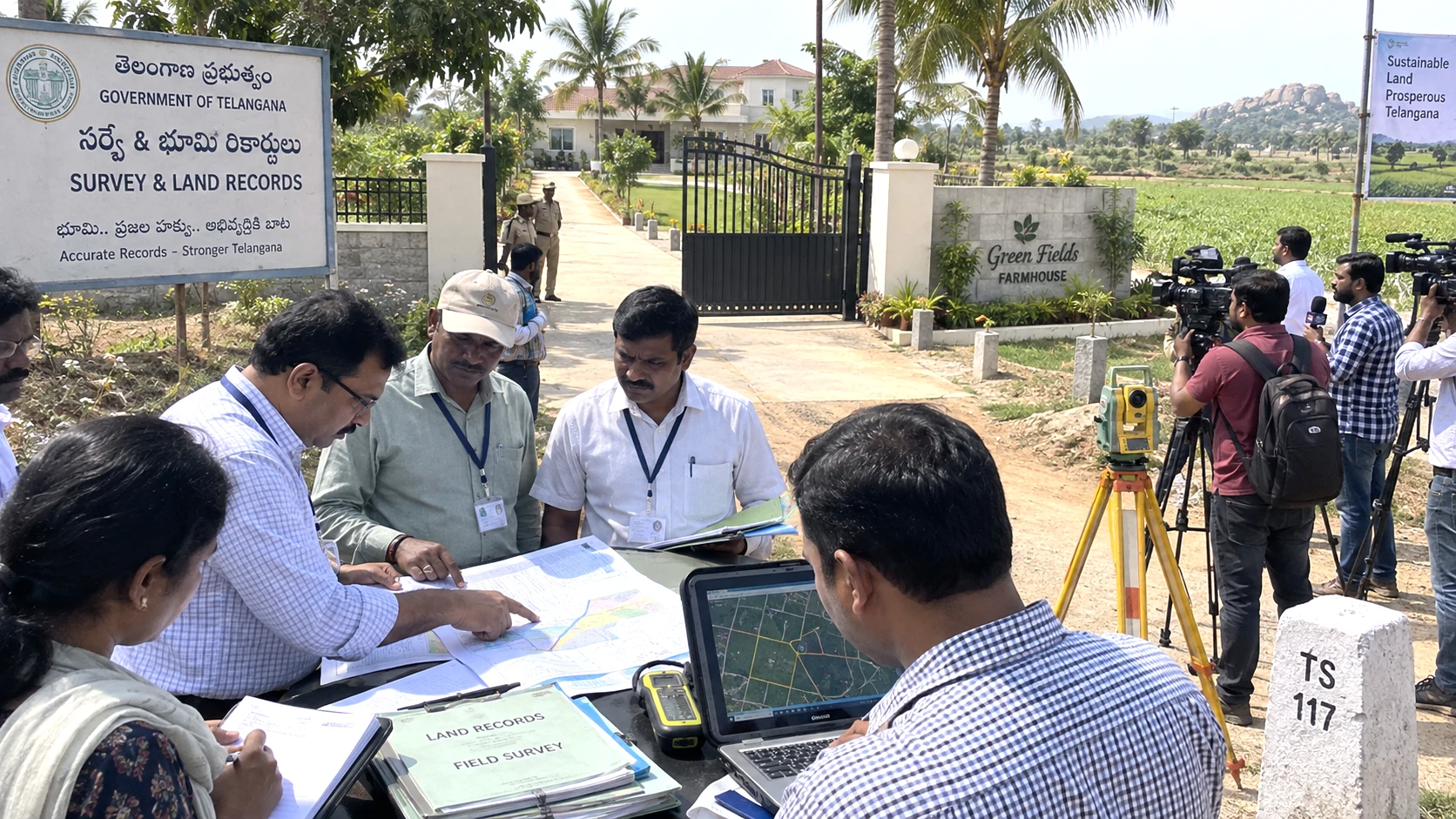
Revenue authorities are examining survey records and government-land classifications around former Chief Minister K. Chandrashekar Rao’s Erravalli property after Chief Minister A. Revanth Reddy raised allegations in the Assembly. The BRS rejects the allegations and has demanded an independent judge-










0 Comments