Hurricane Polo Nears Category 5 Off Mexico After Rapid Intensification
Hurricane Polo has rapidly intensified into a powerful Category 4 storm off southwestern Mexico and is approaching Category 5 strength. Heavy rain, flooding, landslides and dangerous coastal conditions remain the main threats even if the storm's core stays offshore.
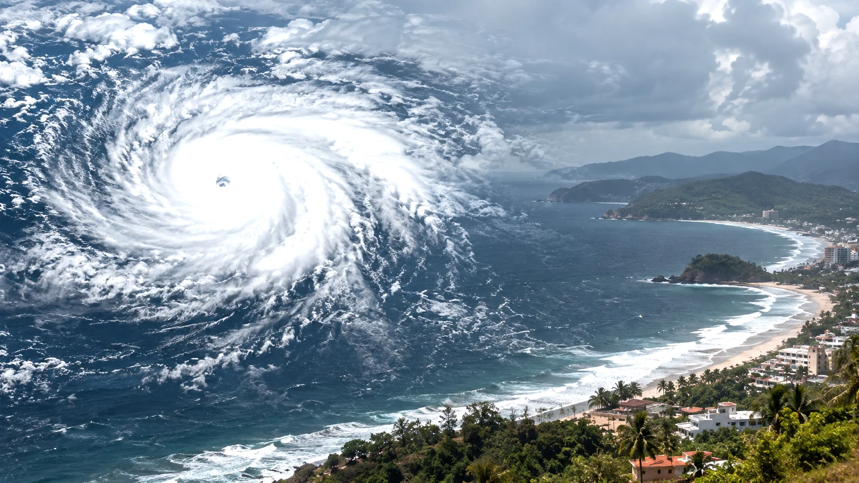
Hurricane Polo strengthening over the eastern Pacific Ocean off southwestern Mexico on September 22, 2026
Table of Contents (16 sections)
MEXICO CITY / MIAMI, September 22, 2026: Hurricane Polo has intensified rapidly into a powerful Category 4 hurricane off Mexico's Pacific coast and is approaching Category 5 strength, while forecasters warn that southwestern Mexico could still face dangerous rainfall, flooding and landslides even if the storm's centre remains offshore.
The US National Hurricane Center said Polo reached Category 4 intensity early on Tuesday, September 22, after strengthening at an exceptional pace over the eastern Pacific.
At 12 a.m. Central Standard Time, or 0600 UTC, the NHC placed Polo about 210 miles, or 340 kilometres, south of Zihuatanejo and about 330 miles, or 530 kilometres, south-southeast of Manzanillo. Maximum sustained winds had increased to 130 mph, or 215 km/h.
The storm continued intensifying after that advisory. Reuters reported at 08:57 UTC that Polo was approaching Category 5 strength, citing the National Hurricane Center. A subsequent report citing NHC Advisory 7 placed maximum sustained winds near 150 mph, leaving Polo only a small increase away from Category 5 intensity.
Despite Polo's extraordinary strengthening, the current forecast keeps the hurricane's core mainly offshore. That does not eliminate the danger for Mexico: the NHC has warned that heavy rainfall could produce life-threatening flooding and mudslides across parts of the country's southwestern coast through Thursday.
Key Takeaways
Recommended Reading
Related Stories & In-Depth Guides
Curated editorial perspectives matching this topic.
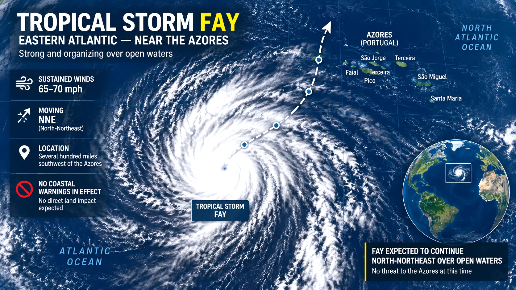
Tropical Storm Fay has strengthened to 70 mph over the eastern Atlantic, putting it just below hurricane intensity southwest of the Azores. Despite its strengthening overnight, forecasters now expect increasing wind shear to weaken Fay beginning Monday, while the rest of the Atlantic basin is foreca
Ukraine has confirmed striking the Moscow Oil Refinery during an extraordinary long-range drone and missile operation against Russia, while Russian authorities say hundreds of drones targeted the capital and more than 1,000 were intercepted across the country. At least three people were reported kil
Hurricane Polo rapidly intensified into a Category 4 storm and is approaching Category 5 strength.
Maximum sustained winds reported near 150 mph in the latest updates.
Forecast keeps the core mainly offshore of southwestern Mexico.
Heavy rain, flooding and landslides remain major threats through Thursday.
Tropical Storm Watch in effect from Tecpan de Galeana to Manzanillo.
Storm remains highly dynamic; intensity and impacts can change quickly.
Hurricane Polo Latest Status
Polo has undergone a dramatic transformation in a short period.
On Monday morning, September 21, it was still a tropical storm with sustained winds of about 65 mph. Later that day it became a hurricane, and by early Tuesday it had reached Category 4 strength.
The latest available information shows a storm continuing to strengthen while remaining south of Mexico's Pacific coastline.
Storm detail
Latest verified information
System
Hurricane Polo
Basin
Eastern Pacific
Current classification
Category 4 hurricane
Latest trend
Rapidly intensifying
Latest reported wind range
At least 130 mph early Tuesday, with later reporting indicating about 150 mph
Main area of concern
Southwestern Mexico
Expected track
Slow movement offshore before turning northwest
Main threats
Heavy rain, flooding, landslides, dangerous surf and tropical-storm-force winds near the coast
Category 5 risk
Polo is approaching Category 5 strength
Watches
Tropical Storm Watch for part of southwestern Mexico
The storm remains highly dynamic, meaning its exact strength, position and forecast impacts can change between advisories.
How Quickly Did Hurricane Polo Intensify?
Polo's rate of strengthening has been one of the most important features of the storm.
At 9 a.m. CST on Monday, the National Hurricane Center classified Polo as a tropical storm with maximum sustained winds of about 65 mph.
By midday, it had become a hurricane with winds of around 80 mph.
At 9 p.m. Monday, Polo had strengthened to 110 mph, putting it just below major-hurricane strength. The NHC said at that time that Polo was still rapidly intensifying and forecast it to become a Category 5 hurricane.
Only three hours later, at midnight CST on Tuesday, Polo's sustained winds had reached 130 mph, making it a Category 4 hurricane. Its central pressure had fallen to 955 millibars.
Later Tuesday morning, the system strengthened further and was reported to be approaching Category 5 intensity.
The rapid change demonstrates why people along Mexico's southwestern coast need to follow current advisories rather than rely on storm information from several hours earlier.
Why Has Polo Strengthened So Rapidly?
The National Hurricane Center had identified an unusually favourable environment for rapid intensification before Polo reached major-hurricane strength.
Forecasters noted that the storm had developed a small inner core while moving over extremely warm ocean water above 30.5°C. Wind shear was relatively light and atmospheric moisture was supportive of further development.
These conditions allow a tropical cyclone to organise more efficiently.
Satellite imagery also showed Polo developing a clearer eye and increasingly organised thunderstorms around its centre as the hurricane intensified.
A NOAA Hurricane Hunter aircraft sampled Polo during its strengthening phase, giving forecasters additional information about winds, pressure and the storm's inner structure.
Rapid intensification can make hurricane forecasting especially important for coastal communities because a storm's potential impact can change substantially in less than a day.
Could Hurricane Polo Become a Category 5 Hurricane?
Yes. The National Hurricane Center has forecast that Polo could reach Category 5 strength.
A Category 5 hurricane begins at sustained winds of 157 mph, or 252 km/h, on the Saffir-Simpson Hurricane Wind Scale.
With Polo already approaching that threshold on Tuesday morning, only a relatively small additional increase in maximum sustained winds would be required.
The NHC's earlier forecast called for Polo to reach around 160 mph during its peak-strength period. However, hurricane intensity forecasts contain uncertainty, and short-term fluctuations can occur because of internal structural changes such as eyewall replacement cycles.
A Category 5 classification would describe Polo's maximum sustained wind intensity. It would not, by itself, determine how severe impacts become on land.
Track, rainfall, storm size, coastal geography and how close the hurricane's strongest winds come to shore all matter when assessing the actual danger to communities.
Will Hurricane Polo Make Landfall in Mexico?
The current forecast does not show the hurricane's core making a direct landfall along southwestern Mexico in the immediate period.
Reuters reported that Polo is expected to move slowly offshore during the next couple of days.
The NHC expects the hurricane to make a sharp turn toward the northwest and west-northwest after its initial east-southeast movement, bringing its track roughly parallel to parts of Mexico's Pacific coast.
However, an offshore centre does not mean southwestern Mexico will avoid significant effects.
Large hurricanes can produce rain, strong winds, high surf and dangerous seas well away from their eye.
The National Hurricane Center has also stressed that uncertainty remains over the precise magnitude and location of impacts as Polo moves closer to the coast.
Residents should therefore avoid interpreting an offshore forecast line as a guarantee of safety.
Which Parts of Mexico Are at Risk?
Coastal and mountainous areas of southwestern Mexico face the greatest immediate concern.
Guerrero and Michoacán are among the states expected to experience the heaviest rainfall, while rain is also possible in Colima, Jalisco and Oaxaca.
Associated Press reported that rainfall totals could reach around 12 inches, or 30 centimetres, in some locations, creating the potential for flooding and mudslides.
The danger can be particularly serious in steep terrain, where intense rainfall can rapidly trigger landslides or send water into communities downstream.
The NHC has repeatedly identified rainfall rather than only the hurricane's extreme central winds as one of the key threats to Mexico.
Tropical Storm Watch in Effect
A Tropical Storm Watch has been issued for a stretch of Mexico's southwestern coastline.
The NHC said the watch extended from Tecpan de Galeana to Manzanillo.
A Tropical Storm Watch means tropical-storm conditions are possible within the specified area, generally within 48 hours.
The watch does not necessarily mean Polo's eye will cross the coastline.
Instead, it reflects the possibility that the outer circulation of the hurricane could bring sustained tropical-storm-force winds to coastal communities.
Authorities may adjust watches or warnings as the hurricane moves and the forecast becomes clearer.
Heavy Rain May Be the Biggest Land Threat
The extreme wind speeds near Polo's eye are receiving significant attention because of the hurricane's rapid intensification, but rainfall may become the most widespread hazard for people on land.
The National Hurricane Center said heavy rainfall associated with Polo would affect coastal portions of southwestern Mexico through Thursday.
Forecasters warned that the rainfall could result in life-threatening flooding and mudslides, especially over steep terrain.
Flash flooding can occur well outside the hurricane's strongest wind field.
This is particularly important for communities living along rivers, drainage channels, hillsides and mountainous roads.
Even if Polo's centre remains offshore, moisture drawn around the hurricane can produce prolonged or intense rainfall bands over land.
Dangerous Surf and Coastal Conditions
Polo is also generating rough seas across the eastern Pacific near southwestern Mexico.
Before the storm had even reached its latest intensity, an NHC high-seas forecast reported significant seas near the hurricane of around 9 metres, or roughly 30 feet, close to the storm's centre.
Conditions near a major hurricane can change quickly, and individual waves can be considerably higher than the reported significant wave height.
Dangerous surf and rip currents can affect coastal areas even when the hurricane's eye remains offshore.
People near beaches and ports should follow local restrictions and instructions from Mexican authorities and local meteorological agencies.
Polo’s Forecast Remains Uncertain
Hurricane forecasts become more uncertain with time, particularly when steering currents are weak or interaction with other weather systems is possible.
The NHC's earlier discussions noted uncertainty in Polo's longer-range path.
Forecasters were also monitoring Tropical Storm Odalys farther west in the Pacific, because the relative positions of the two systems could eventually influence the forecast pattern.
That uncertainty is another reason to avoid treating a single forecast map as a fixed future path.
The official forecast cone represents a range of possible positions for the hurricane's centre. Hazardous conditions can also extend outside that cone.
Hurricane Polo Timeline
Date and time
Development
September 20
Polo develops as a tropical storm in the eastern Pacific
September 21, morning
Polo rapidly strengthens while still a tropical storm
September 21, midday
Polo becomes a hurricane
September 21, evening
Winds rise to around 110 mph
September 22, 12 a.m. CST
Polo reaches Category 4 strength with sustained winds of 130 mph
September 22, early morning
Polo continues rapidly intensifying
September 22, latest update
Polo approaches Category 5 strength while remaining offshore of southwestern Mexico
The timeline illustrates how quickly the storm's classification changed.
What Happens Next?
The next several NHC advisories will be important for three reasons: Polo's peak intensity, the timing of its northwestward turn and how closely its wind and rainfall fields approach Mexico.
The storm may reach Category 5 strength if additional intensification occurs.
At the same time, the forecast keeps the centre offshore during the near term, reducing the likelihood that the hurricane's most extreme inner-core winds directly cross the southwestern coastline.
That distinction should not reduce concern about rainfall.
Flooding and landslides can cause severe effects far from the eye of a tropical cyclone, and the NHC continues to highlight that risk for southwestern Mexico.
People in affected areas should rely on current information from Mexico's meteorological and civil-protection authorities along with updates from the National Hurricane Center.
For readers following Polo from outside Mexico, the most important point is that this remains a rapidly changing hurricane. Intensity figures, warning areas and forecast positions may be revised within hours as new satellite, aircraft and observational data become available.
Frequently Asked Questions
What category is Hurricane Polo now?
Hurricane Polo is a Category 4 hurricane and was approaching Category 5 strength in the latest September 22 update.
How strong are Hurricane Polo's winds?
The NHC reported sustained winds of 130 mph at 0600 UTC on September 22. Later reporting citing the next NHC advisory indicated winds had strengthened further to around 150 mph.
Could Hurricane Polo become Category 5?
Yes. The NHC forecast additional strengthening, and Polo was already approaching the Category 5 threshold on Tuesday morning.
Is Hurricane Polo expected to hit Mexico?
The current forecast keeps the hurricane's core mainly offshore, but southwestern Mexico can still experience heavy rainfall, flooding, landslides, dangerous surf and tropical-storm-force winds.
Which parts of Mexico could be affected?
Guerrero and Michoacán face significant rainfall concerns, with effects also possible in Colima, Jalisco and Oaxaca. A Tropical Storm Watch extends along part of the southwestern Mexican coast.
What is the biggest threat from Polo if the eye stays offshore?
Heavy rainfall and resulting flash flooding and landslides may be among the most significant threats on land, particularly in mountainous terrain.
Bottom Line
Hurricane Polo has rapidly intensified into a powerful Category 4 storm off southwestern Mexico and is approaching Category 5 strength.
The current forecast keeps the core mainly offshore, but heavy rain, flooding, landslides and dangerous coastal conditions remain major threats through Thursday. Residents in Guerrero, Michoacán and neighbouring states should continue following official advisories closely.
Key Takeaway
Polo nears Category 5 after rapid intensification.
Core forecast to stay offshore; rain and landslides main land threats.
Tropical Storm Watch in effect along part of southwest Mexico.
Storm remains highly dynamic; updates can change quickly.
The Rajatheertha Team publishes news, explainers, guides and updates across India and the world. Our coverage follows Rajatheertha's editorial, verification and corrections standards.
The Home Ministry has formally added the Shahzad Bhatti Network to the First Schedule of the UAPA, citing alleged cross-border arms, explosives and narcotics smuggling, recruitment of local criminals and the use of digital platforms for terror-related activity. The designation follows a multi-state
The Supreme Court has reaffirmed that arrested persons must receive the grounds of arrest in writing and in a language they understand, holding that Article 22(1) applies across criminal laws, including special statutes such as PMLA and UAPA.
Revenue authorities are examining survey records and government-land classifications around former Chief Minister K. Chandrashekar Rao’s Erravalli property after Chief Minister A. Revanth Reddy raised allegations in the Assembly. The BRS rejects the allegations and has demanded an independent judge-
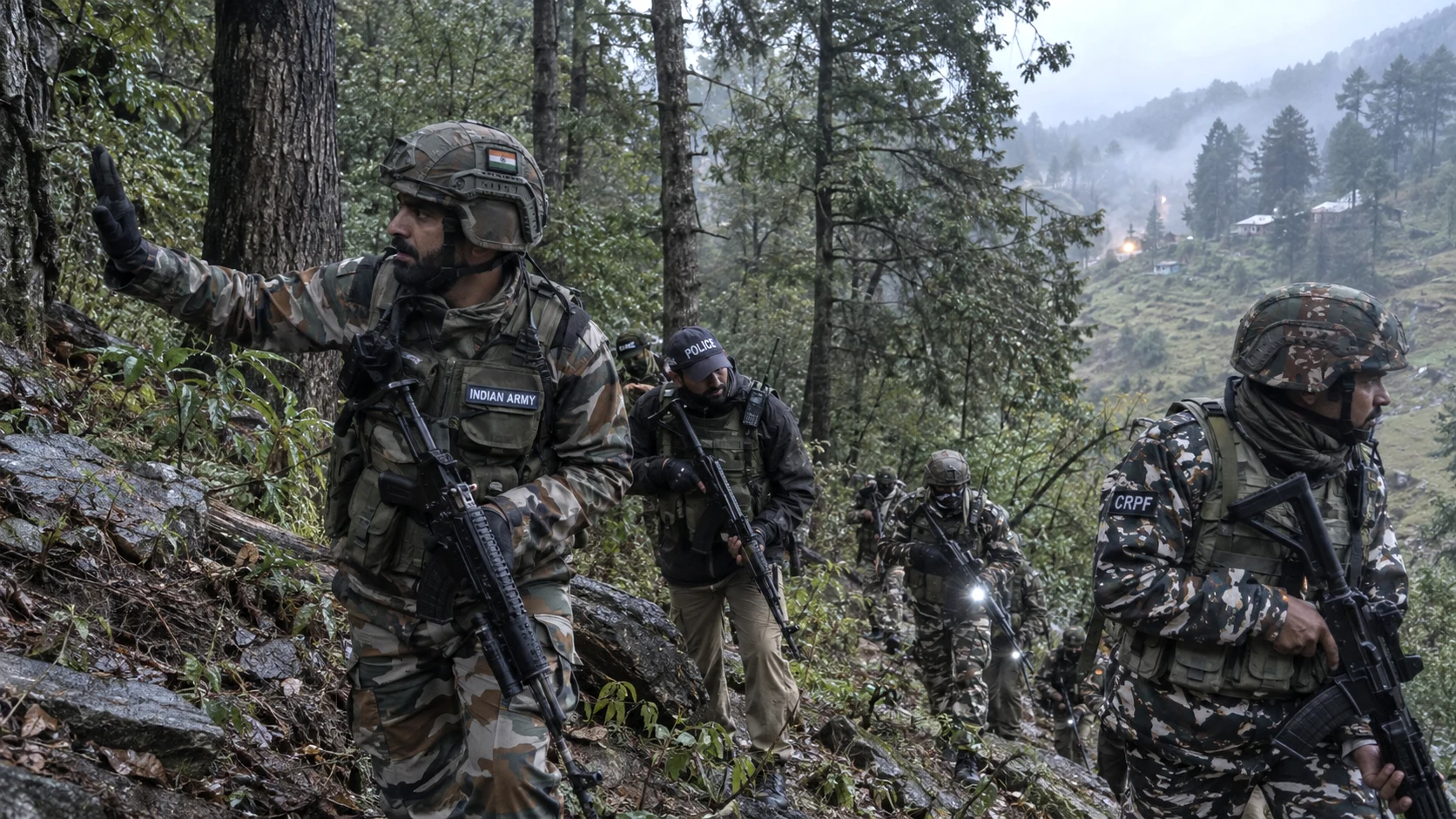
Security forces identified the slain militants as Saddam and Mustafa, both Pakistani nationals associated with Jaish-e-Mohammad. An AK-series rifle, M4 carbine, Glock pistol, grenades and ammunition were recovered after the overnight operation in the Brattal-Sohan forests of Majalta.
The Jagdalpur court imposed capital punishment on all 10 people convicted in the 2013 Maoist ambush on a Congress convoy in Chhattisgarh. Two women are among those sentenced. The death sentences must still go through the High Court confirmation process, and the defence can appeal.
At least nine passengers died after an AC sleeper bus caught fire on the Yamuna Expressway near Jewar in Greater Noida. Police are investigating the cause, while a survivor’s complaint alleges warnings about a burning smell were ignored.










0 Comments