Hurricane Polo Weakens to Category 4 as Rainbands Reach Southwest Mexico: Latest Path, Rainfall and Warnings
Hurricane Polo has weakened slightly from Category 5 to a powerful Category 4 storm off southwest Mexico, while outer rainbands reach the coast and raise flooding, mudslide and dangerous-surf risks.
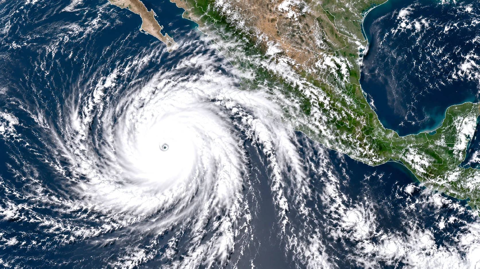
Hurricane Polo as a powerful Category 4 storm off the southwestern coast of Mexico with outer rainbands reaching land
Table of Contents (17 sections)
Hurricane Polo remained a powerful major hurricane off Mexico's southwestern Pacific coast on Wednesday, September 23, after weakening somewhat from Category 5 intensity while its outer rainbands began reaching coastal communities.
The U.S. National Hurricane Center's 6 a.m. CST update placed Polo about 165 miles, or 270 kilometres, south of Zihuatanejo, Mexico, and around 320 miles, or 515 kilometres, southeast of Manzanillo.
Maximum sustained winds were estimated at around 150 mph, or 240 km/h, placing Polo in Category 4 on the Saffir-Simpson Hurricane Wind Scale.
The hurricane was drifting northward at only about 2 mph, or 4 km/h, with a minimum central pressure estimated at 922 millibars.
Polo had reached Category 5 intensity earlier, including maximum sustained winds of around 165 mph, or 270 km/h, around midnight local time on September 23 before weakening somewhat.
The National Hurricane Center cautioned that further fluctuations in strength were possible and that Polo was expected to remain a during the next several days.
Recommended Reading
Related Stories & In-Depth Guides
Curated editorial perspectives matching this topic.
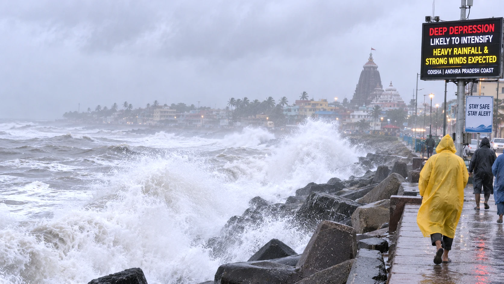
A deep depression over the Bay of Bengal is nearing the north Andhra Pradesh–south Odisha coast as IMD warns of extremely heavy rain in parts of Telangana, Odisha and coastal Andhra Pradesh.
Ukraine has confirmed striking the Moscow Oil Refinery during an extraordinary long-range drone and missile operation against Russia, while Russian authorities say hundreds of drones targeted the capital and more than 1,000 were intercepted across the country. At least three people were reported kil
very powerful major hurricane
The most immediate danger to Mexico may not come from the hurricane's eye crossing the coastline.
Current forecasts keep Polo's core offshore, but the hurricane is moving slowly enough and close enough to land that heavy rain, tropical-storm conditions, dangerous surf and rip currents may affect parts of southwestern Mexico even without a direct landfall.
Key Takeaways
Hurricane Polo weakened from Category 5 to Category 4.
Maximum sustained winds around 150 mph / 240 km/h.
Located about 165 miles south of Zihuatanejo.
Outer rainbands already reaching the Mexican coast.
Core expected to remain offshore under current forecast.
Main threats: heavy rain, flooding, mudslides and dangerous surf.
Hurricane Polo Latest Status
Hurricane Polo
Latest verified status
Classification
Category 4 major hurricane
Maximum sustained winds
Around 150 mph / 240 km/h
Movement
North at about 2 mph / 4 km/h
Minimum pressure
About 922 mb
Position
About 165 miles south of Zihuatanejo
Expected landfall
Core currently forecast to remain offshore
Main Mexico threats
Heavy rain, flooding, mudslides, tropical-storm winds and dangerous surf
Because Polo is moving extremely slowly and its intensity has already fluctuated between Categories 4 and 5, these numbers should be treated as a snapshot rather than a fixed forecast.
Polo Was Category 5 Earlier Wednesday
Polo's intensity has changed significantly within a matter of hours.
At 12 a.m. CST on Wednesday, the National Hurricane Center classified the storm as a Category 5 hurricane with maximum sustained winds of about 165 mph.
At that time, Polo was nearly stationary roughly 200 miles south of Zihuatanejo, with a minimum pressure of around 905 millibars.
By 3 a.m., NHC estimated winds near 155 mph, bringing Polo just below the Category 5 threshold and back into Category 4.
By the 6 a.m. update, winds were estimated at 150 mph.
This does not mean the threat has ended.
A Category 4 hurricane is still an extremely powerful tropical cyclone, and NHC expects Polo to remain a major hurricane while travelling near Mexico's Pacific coast.
What Is the Category 5 Threshold?
Under the Saffir-Simpson Hurricane Wind Scale, a Category 5 hurricane has maximum sustained winds of at least 157 mph, or 252 km/h.
A Category 4 storm has sustained winds between 130 and 156 mph.
That means Polo's shift from approximately 165 mph to 150 mph changes its official category, but the difference does not remove the potential for serious coastal impacts.
The category also describes wind intensity only.
It does not directly measure rainfall, flash-flood risk, landslides, storm surge or dangerous surf.
Those hazards can affect areas well away from the hurricane's centre.
Polo's Outer Rainbands Have Reached Mexico
One of the biggest developments on September 23 is that Polo's outer rainbands have begun reaching the southwestern Mexican coastline.
NHC said early Wednesday that the storm's northern bands were brushing the coast, while satellite and scatterometer observations indicated tropical-storm-force winds just offshore.
Reuters later reported that Polo's rainbands had reached Mexico's Pacific coast, increasing concerns about flooding and mudslides as the hurricane remained nearby.
This means communities can experience meaningful impacts even though Polo's eye remains hundreds of kilometres offshore.
Will Hurricane Polo Make Landfall in Mexico?
Current forecasts indicate the centre of Polo is likely to remain offshore while tracking close to Mexico's southwestern coastline during the next day or two.
CBS News, citing the National Hurricane Center, reported that the storm was expected to skirt the coastline rather than make landfall under the current forecast.
However, forecasts contain uncertainty.
Polo is moving unusually slowly, and even relatively small shifts in its track could change which coastal areas experience the strongest wind and rain.
For that reason, residents should follow updated NHC and Mexican government advisories rather than assuming that an offshore forecast means no local impact.
Hurricane Polo Path: Where Is It Heading?
Polo was moving slowly northward on Wednesday morning.
NHC's forecast keeps the hurricane near southwestern Mexico over the near term, with its core expected to remain offshore.
The slow movement is important because it can prolong the period during which moisture-laden rainbands affect the same coastal and mountainous areas.
Longer-range forecasts suggest the hurricane could eventually move farther away from the immediate Guerrero-Michoacán coastline, but confidence generally decreases farther into the forecast period.
The exact path should therefore be checked against each new NHC advisory rather than relying on a static map from earlier in the day.
Mexico Tropical Storm Warning
Mexico has issued a Tropical Storm Warning from:
Tecpan de Galeana to Punta San Telmo.
A Tropical Storm Watch extends westward from Punta San Telmo to Playa Pérula.
These alerts do not mean hurricane-force winds are necessarily expected onshore.
They indicate that tropical-storm-force conditions are expected or possible within the specified coastal zones as Polo passes offshore.
Tropical-storm conditions were expected in parts of the warning area during Wednesday, while they could develop in the watch area by Thursday.
How Much Rain Could Polo Bring?
Rainfall remains one of Polo's most significant threats.
According to forecasts cited by CBS News, Guerrero and Michoacán could receive around 3 to 6 inches of rain through Thursday, with isolated totals approaching 8 inches.
Coastal parts of Oaxaca, Colima and Jalisco could receive around 2 to 4 inches.
Reuters also reported that Guerrero and Michoacán could receive approximately 3 to 8 inches, or 8 to 20 centimetres, as Polo's rainbands move across southwestern Mexico.
Rainfall amounts will not be uniform.
Mountainous terrain can enhance rainfall considerably in some locations while nearby areas receive lower totals.
Flooding and Mudslide Risk
The National Hurricane Center warns that Polo's rainfall may produce life-threatening flooding and mudslides, particularly in steep terrain across Guerrero and Michoacán.
This risk can persist even if hurricane-force winds remain offshore.
Mountain slopes can become unstable after prolonged or intense rainfall, while rivers and streams may rise rapidly.
Potential effects may include:
flash flooding;
overflowing streams and rivers;
landslides or mudslides;
flooded roads;
isolated communities;
transport disruption; and
local power or communications problems.
These are potential impacts associated with the rainfall forecast, not predictions that every warned community will experience them.
Why a Slow-Moving Hurricane Can Be Dangerous
Polo's slow movement is particularly important for rainfall.
At only a few miles per hour, rainbands can continue feeding moisture into the same areas for many hours.
This increases the chance of flash flooding and landslides even when the hurricane's strongest winds remain over the ocean.
Slow-moving systems often produce higher rainfall totals than faster-moving storms of similar intensity.
Dangerous Surf and Rip Currents
Even without a direct landfall, Polo is expected to generate large swells and dangerous surf along the southwestern Mexican coast.
Rip currents can be life-threatening for swimmers and people near the shoreline.
Beachgoers and coastal residents should stay out of the water and keep a safe distance from the surf zone while the hurricane remains nearby.
What Residents and Visitors Should Do
People in the warned coastal areas of Guerrero, Michoacán, Colima, Jalisco and Oaxaca should:
monitor the latest National Hurricane Center and Mexican Civil Protection updates;
prepare for heavy rain and possible flooding;
avoid driving through flooded roads;
stay away from rivers, streams and steep slopes during intense rainfall;
secure outdoor items that could become projectiles in strong winds;
and follow any local evacuation or shelter instructions if issued.
Visitors in coastal resorts should check with hotel staff and local authorities for the latest guidance.
Latest Verified Snapshot
As of the 6 a.m. CST advisory on September 23:
Polo is a Category 4 hurricane with winds near 150 mph.
It is located about 165 miles south of Zihuatanejo.
Movement is slow — about 2 mph toward the north.
Outer rainbands are already affecting parts of the southwestern Mexican coast.
The core is currently forecast to remain offshore.
Heavy rain, flooding, mudslides and dangerous surf are the primary concerns for Mexico.
Intensity and track can still change. Updated advisories from the National Hurricane Center remain the most reliable source of information.
Frequently Asked Questions
Is Hurricane Polo still a Category 5?
No. Polo weakened from Category 5 to Category 4. Maximum sustained winds were estimated at around 150 mph in the 6 a.m. CST update on September 23.
Will Hurricane Polo make landfall in Mexico?
Current forecasts keep the centre of Polo offshore. However, outer rainbands are already reaching the coast and tropical-storm conditions are possible in warned areas.
Which parts of Mexico are most at risk?
Coastal and mountainous areas of Guerrero and Michoacán face the highest rainfall and flooding risk. Tropical Storm Warnings and Watches cover sections of the southwestern coast from Tecpan de Galeana westward.
How much rain is expected?
Guerrero and Michoacán could see 3 to 6 inches of rain, with isolated totals near 8 inches. Coastal parts of Oaxaca, Colima and Jalisco may receive 2 to 4 inches.
Why is the slow movement important?
A slow-moving hurricane can dump rain over the same areas for a longer period, increasing the risk of flash flooding and mudslides.
Are beaches safe?
No. Dangerous surf and strong rip currents are expected along the southwestern Mexican coast. People should stay out of the water.
Bottom Line
Hurricane Polo has weakened from Category 5 to a still-powerful Category 4 storm off southwest Mexico. Its outer rainbands are already reaching the coast, bringing the risk of heavy rain, flooding, mudslides and dangerous surf even if the core remains offshore.
Residents and visitors in Guerrero, Michoacán and nearby coastal areas should stay alert to the latest National Hurricane Center and local government updates.
The Rajatheertha Team publishes news, explainers, guides and updates across India and the world. Our coverage follows Rajatheertha's editorial, verification and corrections standards.
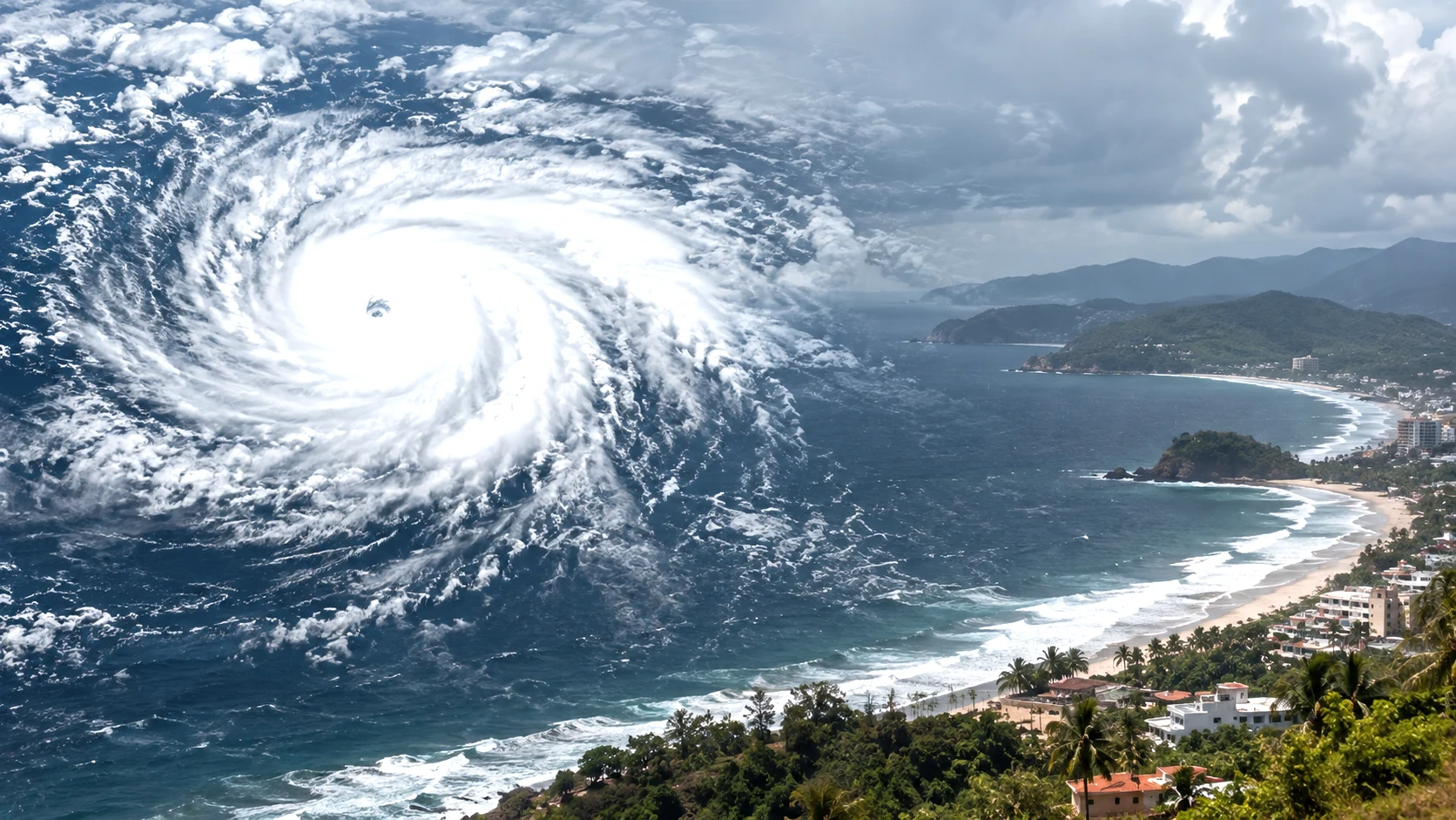
Hurricane Polo has rapidly intensified into a powerful Category 4 storm off southwestern Mexico and is approaching Category 5 strength. Heavy rain, flooding, landslides and dangerous coastal conditions remain the main threats even if the storm's core stays offshore.
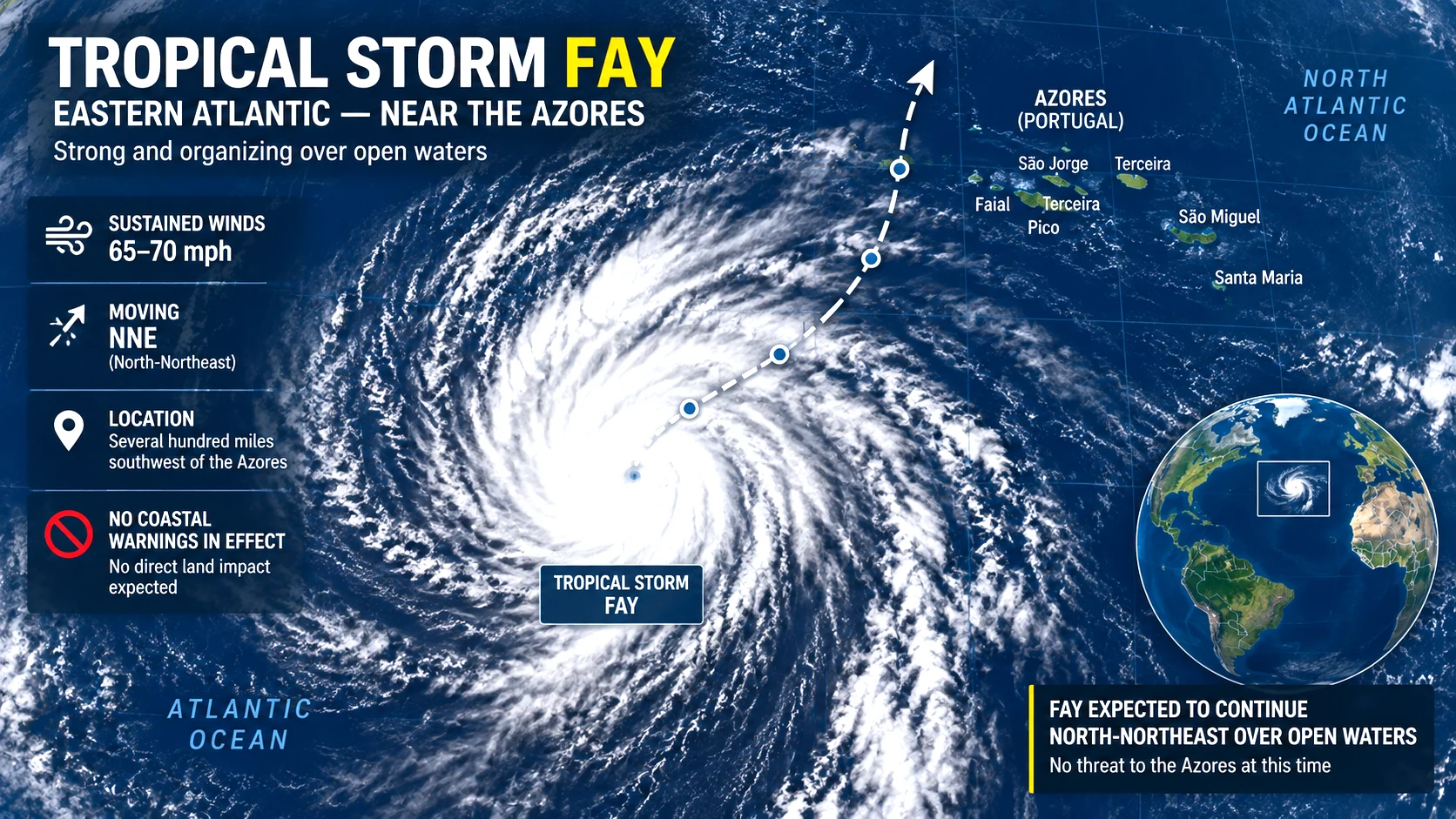
Tropical Storm Fay has strengthened to 70 mph over the eastern Atlantic, putting it just below hurricane intensity southwest of the Azores. Despite its strengthening overnight, forecasters now expect increasing wind shear to weaken Fay beginning Monday, while the rest of the Atlantic basin is foreca
The Home Ministry has formally added the Shahzad Bhatti Network to the First Schedule of the UAPA, citing alleged cross-border arms, explosives and narcotics smuggling, recruitment of local criminals and the use of digital platforms for terror-related activity. The designation follows a multi-state
The Supreme Court has reaffirmed that arrested persons must receive the grounds of arrest in writing and in a language they understand, holding that Article 22(1) applies across criminal laws, including special statutes such as PMLA and UAPA.
Revenue authorities are examining survey records and government-land classifications around former Chief Minister K. Chandrashekar Rao’s Erravalli property after Chief Minister A. Revanth Reddy raised allegations in the Assembly. The BRS rejects the allegations and has demanded an independent judge-
Central Government employees and pensioners are scheduled to receive September 2026 salary, wages and pension in advance on Friday, September 25, ahead of the proposed September 28–30 bank strike. Here is who is covered and what the order means.









0 Comments